
The Appalachian Trail in the Great Smoky Mountains of Tennessee includes a section 71 miles in length that serves as a boundary for Tennessee and North Carolina in the Great Smoky Mountains. One popular approach is to park at the Newfound Gap parking area.
The Applachian Trail follows along at the upper most parts of the Smoky Mountains National Park that separates North Carolina from Tennessee. For this reason, the trail often experiences bad or severe weather and is exposed to of the other elements that make the Smoky Mountains a wild and wonderful place. Please use caution.
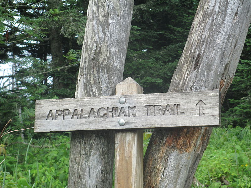
Over View / Appalchian Trail
The Appalachian Trail winds it’s way across the mountain and valley of The Smoky Mountains National Park. The Appalachian Trail was completed in 1937 and is a marvelous tribute to the well-meaning individuals who overcame many obstacles to create this splendid national treasure. The trail is over 2,015 miles long and traverse through parts of 14 states. Its southern end termination point is Springer, GA and it starting point is (or ending, depending on your direction) on Mount Katahdin, Maine.
Tennessee
The Appalachian Trail in the Great Smoky Mountains of Tennessee includes a section 71 miles in length that serves as a boundary for Tennessee and North Carolina in the Great Smoky Mountains. One popular approach is to park at the Newfound Gap parking area. From this area, you can hike along portions both north and south along the Trail. One popular destination is north to Charlies Bunion. From Charlies Bunion, fire clearings above steep mountain slopes afford spectacular views to peaks and valleys below. The section that runs just below the summit of Clingmans Dome in Great Smoky Mountains National Park is along the North Carolina and Tennessee border and is the highest point on the trail at 6,625 feet
Cover image: By Billy Hathorn (Own work)


