
A fairly easy 5-mile trek (round-trip) that is ideal for the beginner or a family. It will take about three hours, depending on your skill level. Since the departure point for this hike lies within Cades Cove the most visited “must see” area of the Smoky Mountains Nation Park, you will have plenty of company.
Directions To Cades Cove
From Townsend take East Lamar Alexander Parkway (route 321) to the only traffic light in Townsend. Continue through the traffic light on to Route 73 (this is still East Lamar Alexander Parkway) that will take you up into the National Park. When you come to the fork in the road, veer right on Laurel Creek Road and follow it to Cades Cove. From the Gatlinburg area, turn right at the Sugarlands Visitor Center onto (route 73) Little River Road and follow that through the Park until you come to the place where you will turn left on to Laurel Creek Road, that will take you on upto Cades Cove.
From Cades Cove- The road round Cades Cove is a one way road. So follow that about half way around and you come to a creek, cross over the creek and Turn right between signposts 10 and 11 when you see the sign for Abrams Falls, follow this little road back through the field to where you can park your car and begin your hike to the falls!
Point of departure
Drive along the one-way Cades Cove Loop Road 4.9 miles, and turn right onto a gravel road , just before reaching the Cades Cove Visitors Center. Take the gravel road to the large parking lot for the trailhead. Signs mark the area well. The Abrams Falls Trail begins at the wooden bridge at the end of the parking area.Bring water along with you for the hike! Never drink the water from a Park stream without boiling it first. The streams in the park contain bacteria that will make you sick.
Summary
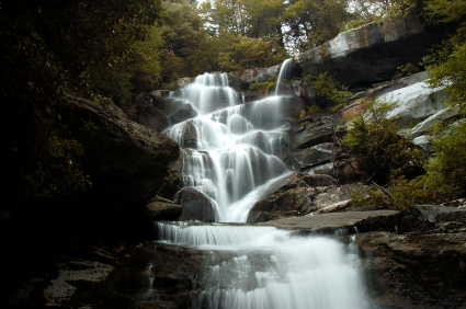
A fairly easy 5-mile trek (round-trip) that is ideal for the beginner or a family.Most hiking guides have this trail listed as “moderate” on the difficulty rating. It will take about three hours, depending on your skill level. Note here for mom’s: A visit to Cades Cove is a must. But you can expect it to be an all day affair even in the “off seasons”. So you might just as well take time to do the hike. But we recommend bring along a picnic lunch, water and other items you may need to keep the family feed, hydrated and in good spirits! Since the departure point for this hike lies within Cades Cove the most visited “must see” area of the Smoky’s, expect plenty of company along the trail. Even so the hike to Abrams Falls is more than reward enough for the effort. The trail to Abrams Falls parallels Abrams Creek most of the way, except when Abrams Creek reaches Arbutus Ridge, a stretch of the creek that is popular with trout fishermen. At mile 2.5 you will cross Wilson Branch and take the short side trail to the falls.
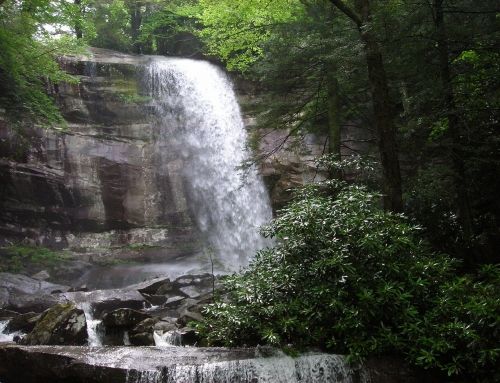
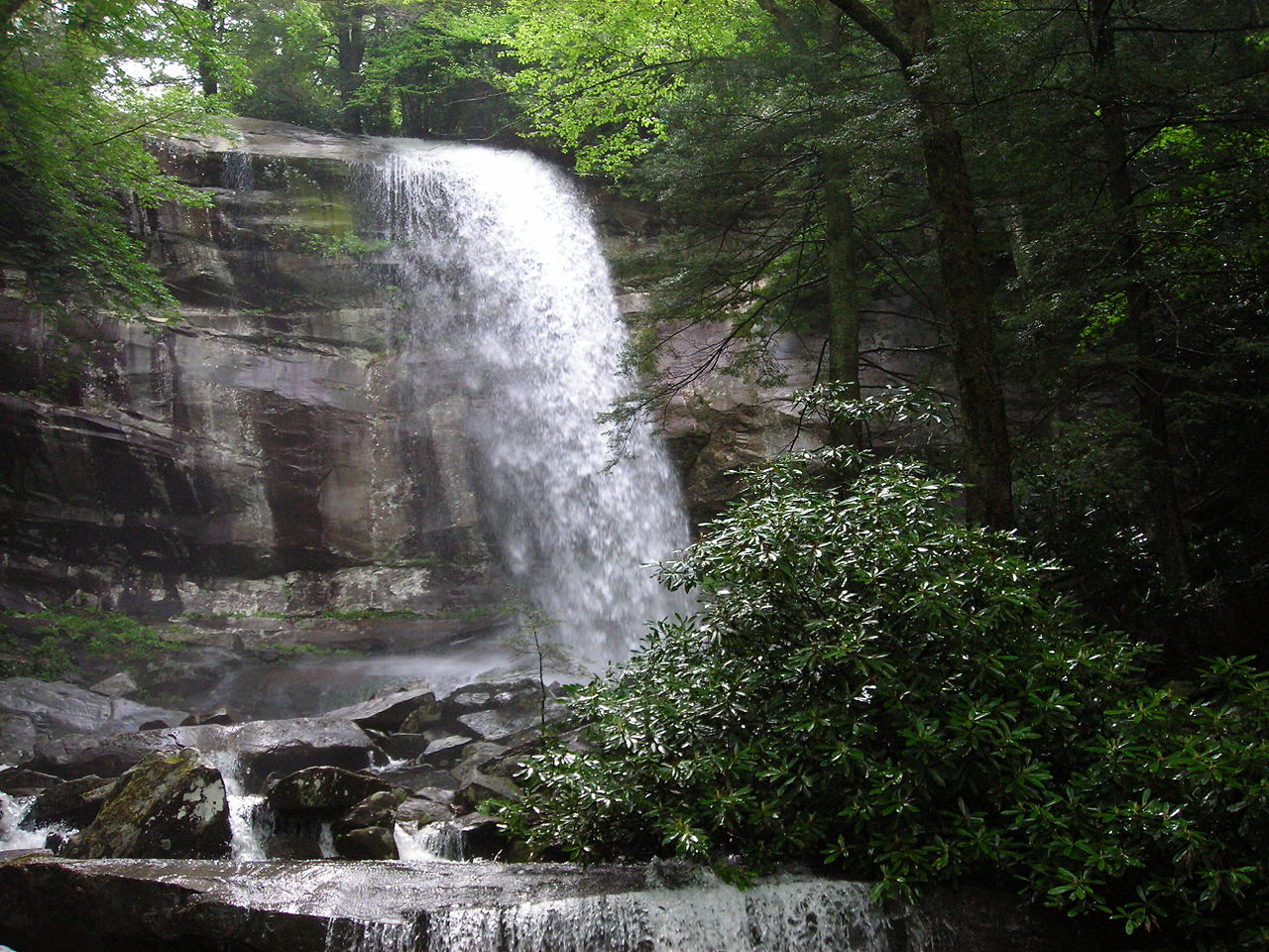
The Highlight of the falls is not the drop. The falls only drops about 20 – 25 feet. What makes this falls special is the volume of water that cascades over the falls! Abram Falls probably has the greatest volume of water than any other falls in the Smokies! It creates swift currents and can be extremely dangerous for anyone trying to climb the falls or swim in the pool.
Elevation
You will climb to approximately 1,800 feet at one point, but when you arrive at the falls you are actually 300 feet lower than when you started.
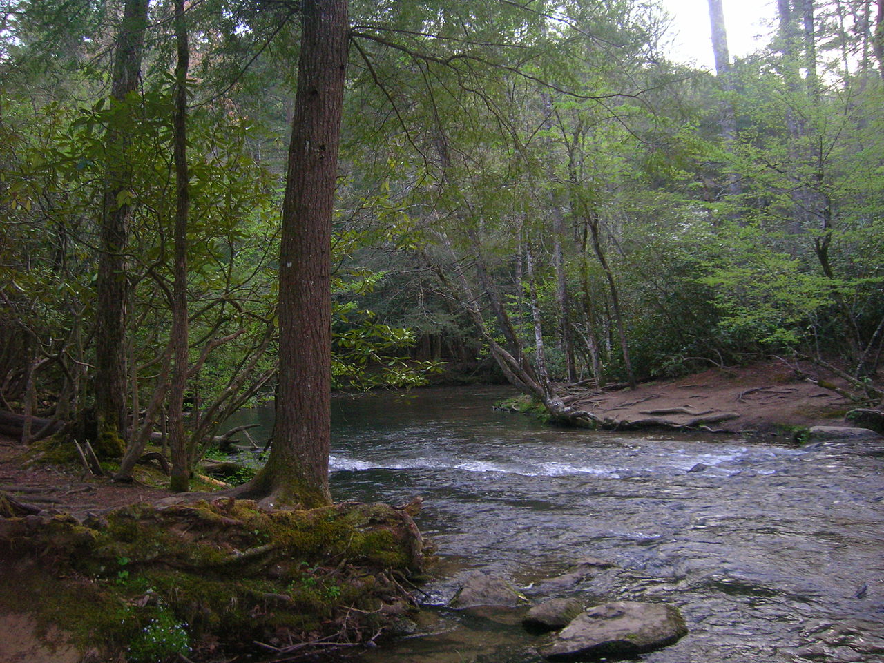
“Abrams Creek Near Trailhead” by No machine readable author provided. Blinutne assumed (based on copyright claims). – No machine readable source provided. Own work assumed (based on copyright claims).. Licensed under CC BY-SA 3.0 via Commons – https://commons.wikimedia.org/wiki/File:Abrams_Creek_Near_Trailhead.JPG#/media/File:Abrams_Creek_Near_Trailhead.JPG
